For years, discussions have circulated among officials and within media outlets about populated regions situated near fault lines, such as Istanbul, Seattle, and Tokyo, being “overdue” for catastrophic earthquakes. This notion has also been applied to the central Himalaya fault segment in India and Nepal.
The last major recorded earthquake in this specific area occurred in 1505. Based on this, some prior research suggested a recurring pattern, positing that major seismic events in this region happen approximately every 500 years. This led to the concern that a significant earthquake was imminent.
Random Seismic Activity: A New Perspective
However, a recent analysis challenges this long-held belief. Scientists have discovered evidence indicating that at least 50 earthquakes, each measuring magnitude 6.5 or larger, have occurred in this region over the past 6,000 years. Crucially, eight of these significant events have taken place since the 1505 earthquake. The findings suggest these earthquakes have been occurring randomly, rather than following a predictable, cyclical pattern.
Zakaria Ghazoui-Schaus, who led the study at the British Antarctic Survey, emphasized the need to shift the scientific discourse. “We have to stop discussing and having long debates over the periodicity of earthquakes in the Himalayas and come to an agreement that it’s a random process… and consider the risk within that framework,” he stated.
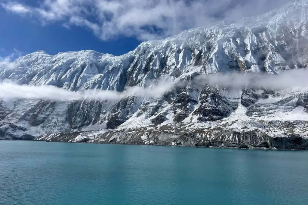
The Tectonic Context of the Himalayas
The dramatic formation of the Himalaya mountains is a direct result of the ongoing collision between the Indian and Eurasian tectonic plates. This geological process continues today, creating one of the planet’s most substantial seismic zones. The extensive fault line, spanning 2,400 kilometers beneath the mountain range, is responsible for generating powerful earthquakes. A striking example is the magnitude 7.8 earthquake in 2015, which tragically claimed the lives of nearly 9,000 people in and around Kathmandu.
Debunking the “Seismic Gap” Theory
While a considerable amount of evidence points to seismic activity throughout the Himalayan fault, less historical data has been available for the central segment, located directly west of Nepal’s capital. This scarcity of information led to the hypothesis that a “seismic gap” was forming, suggesting that immense pressure was accumulating in this area and was poised for release in a devastating earthquake, potentially measuring magnitude 8 or 9.
Ghazoui-Schaus contends that this interpretation was a misapprehension, stemming from a “knowledge gap” rather than an actual seismic void. Traditional methods of paleo-seismology, which involve digging trenches to identify past ground ruptures, have primarily uncovered evidence of large earthquakes that reached the surface. These methods, however, tend to overlook smaller “shadow earthquakes” that did not manifest on the surface.
Roger Musson, a retired seismologist from the British Geological Survey, explained the limitations. “You are only going to have a very sparse record of the largest earthquakes,” he remarked, referring to traditional paleo-seismology. He contrasted this with historical records, noting, “Whereas for historical earthquakes, then the catalogue can be good down to about magnitude 4 or so.”
Consequently, a record dominated by major seismic events produced calculations of extended “interevent intervals,” also known as “return periods.” This metric used to represent the average time between earthquakes of a specific magnitude in a given area.
Uncovering a Deeper Seismic History
To establish a more comprehensive record of seismic activity in the central Himalaya, Ghazoui-Schaus and his team conducted research at Lake Rara in western Nepal in 2013. They retrieved a four-meter sediment core from the lakebed using an inflatable raft.
The subsequent analysis of this core focused on turbidites. These are layers of fine sediments deposited on coarser ones, indicating past underwater landslides triggered by earthquakes. The research team has now identified 50 earthquakes of magnitude 6.5 or greater within the last 6,000 years, with each event dated based on its position within the sediment core. Ghazoui-Schaus suggests that these past seismic events have likely dissipated energy and reduced tension along the fault.
Clustering and Randomness in Earthquakes
Statistical analysis revealed that the identified earthquakes often occurred in clusters. However, these clusters themselves appeared to manifest randomly. While this aligns with what most seismologists anticipate based on contemporary instrumental records, Ghazoui-Schaus noted that this is one of the first times a paleo-seismological record has corroborated this finding.
Ghazoui-Schaus offers practical advice for individuals in the region. “If I have to build a house in western Nepal, I would definitely be more cautious in the way that I would build,” he said. Musson further explained that even though earthquakes occur randomly, calculating their average interval remains valuable. This calculation can serve as an indicator of seismic activity that could potentially impact infrastructure like bridges or dams.
“If you’re planning for the next hundred years, you want to know how many earthquakes of a certain size are going to occur in that period,” Musson stated. “And if you are prepared for that, then it doesn’t matter whether the earthquake happens next year or in 10 years’ time, because you’ve built your dam strong enough.”
Journal reference: Science Advances DOI: 10.1126/sciadv.adx7747